
 Advances in Biology and Cartography: The Expedition of Lewis and Clark
by Tyler Johnson
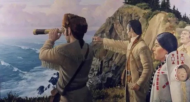
In the early 1800’s, Thomas Jefferson proposed that Congress send an expedition into the new territory acquired by the Louisiana Purchase. Meriweather Lewis and Willliam Clark were selected to lead the Corps of Discovery into this unfamiliar territory. The expedition returned just over two years later and came back with a plethora of knowledge and information about their various discoveries. The Lewis and Clark expedition achieved advances in biology, cartography, and diplomacy and their mission was remarkably successful.
The expedition had a handful of major goals, one of which was the documentation of the various plants and animals encountered and observed on the trip. A great many varieties of animals were catalogued, such as the grizzly bear, the pronghorn, the grey wolf, the swift fox, and the porcupine among others. Paul A. Johnsgard from the Journals of the Lewis and Clark Expedition states that “…nearly 100 previously unknown species or subspecies of vertebrate animals were encountered and variously described by Lewis and Clark…” (Johnsgard). All of which would eventually be studied further and would lead to a greater general understanding of zoology at the time. Furthermore, documenting fauna was not the only goal. The various plant species that were encountered were to be documented as well. According to the US Department of Agriculture, “Lewis and Clark discovered a total of 178 plants new to western science…” (USDA). Ambrose notes, “Anyone who has ever canoed on the upper Missouri River knows what a welcome sight a grove of cottonwoods can be. They provide shade, shelter, and fuel. For Indian ponies, they provide food. For the Corps of Discovery, they provided wheels, wagons, and canoes” (Undaunted Courage). Like the animals observed and documented, the classification of these plant species expanded their understanding of plant life and biology. The expedition was extraordinarily successful in documenting the flora and fauna of the American West.
One of the most important parts of an expedition such as the Lewis and Clark expedition is cartography or map making. As such, the documentation of the general terrain during the Discovery Corps expedition was a primary goal. Several skilled cartographers went along the journey. Because of the importance of map making, William Clark himself was a skilled cartographer (which makes sense). It was because of this that the entire path taken during the journey was painstakingly recorded and documented. Ralph Ehrenberg writes that “[The Discovery Corps] prepared about 140 maps on the trail…”(Ehrenburg) and the crew acquired around thirty maps from various Native American tribes and traders that they encountered. This is just under two hundred maps produced and acquired to assess and represent the land explored. After the expedition concluded, the maps were reproduced and studied. The expedition resulted in a greater understanding of the new territory. The maps provided vital knowledge of the geography and geology of the landscape as well as the location of various native American tribes for the purposes of trade.
Since several native American tribes were located within the territory acquired in the Louisiana Purchase, a major goal of the Discovery Corps expedition was to establish trade relationships as well as document the culture of the tribes. Lewis and Clark would council with the chiefs of the villages and often offer tokens of goodwill (such as the Jefferson medals) or even offer up tobacco to smoke as documented in Clark’s journal, “…we sent three twists of Tobacco by three young men, to the three villages above [i]nviting them to come down & council with us tomorrow” (Clark, 209). During the expedition, diplomatic relationships were established with around fifty different Native American tribes including the Lenape, Osage, Lemhi, Lakota, and Chinook among many others. Every tribe was slightly different and several had rivalries against each other. The crew learned the traditions and culture of these tribes which helped in establishing diplomatic and trade relationships.
The Lewis and Clark expedition had a lofty number of major goals to accomplish during their 8,000-mile trip: “Whilst I viewed those mountains, I felt a secret pleasure in finding myself so near the head of the–heretofore conceived–boundless Missouri. But when I reflected on the difficulties which this snowy barrier would most probably throw in my way to the Pacific Ocean, and the sufferings and hardships of myself and the party in them, it in some measure counterbalanced the joy I had felt in the first moments in which I gazed on them. But… I will allow it to be a good, comfortable road until I am compelled to believe otherwise” (William Clark). Despite the crew’s many trials and tribulations, the Discovery Corps was extremely successful in the discovery, classification, and documentation of the land, locals, plants, and animals of the Mississippi River and beyond providing important scientific information about the new land.
Works Cited
Ambrose, Stephen E. Undaunted Courage: The Pioneering First Mission to Explore America’s Wild Frontier. Simon & Schuster, 2003.
Ehrenberg, Ralph. “Route Mapping on the Lewis and Clark Expedition.” Smithsonian Institution, 2000.
Johnsgard, Paul. “Lewis and Clark on the Great Plains.” Journals of the Lewis and Clark Expedition, 2003.
Lewis, Meriweather and Clark, William. Original Journals of the Lewis and Clark Expedition: 1804-1806 from American Journeys – Wisconsin Historical Society Online Collections, 2003.
“Lewis and Clark.” United States Department of Agriculture, 1 Jan. 2025. Lewis & Clark: USDA ARS.